-
Content Count
2,144 -
Joined
-
Last visited
-
Days Won
60
Everything posted by Illyria
-
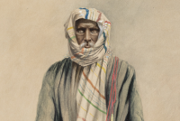
The Lorian swamp in the north-west corner of the country is in the rainy season for the most part a morass with a circumference of about 60 to 70 miles, but having moderately deep pools of water surrounded by reeds. In the dry season it is a mud flat with a permanent supply of water in its midst. This swamp is supplied from the slopes of the Aberdare mountains and Mount Kenya with water which enters it by the E. Uaso Nyiro river. There is a clearly defined river-bed, called the Lak Dera, connecting the Lorian swamp with the Wama lake. This river-bed is now dry, but the natives report that water has been known to flow down it as far as Afmadu (black mouth), which is a district about 30 miles from the river Juba. The general direction of the above-mentioned Lak Dera (long stream) is east until it reaches the Afmadu district, where it is joined by the Lak Jera river-bed, and this has a stream of water during the season of heavy rains. After passing Afmadu the united river-bed turns almost due south until it reaches the Deshek Wama (Wama lake), a lake which formerly had permanent water extending 16 miles in length by about 2 miles in breadth. This lake was formerly fed by a stream proceeding from the river Juba at a point about 50 miles from its mouth, and it was drained by another stream entering the Juba 20 miles from its mouth, near the town of Yonti (noisy place). The feeding stream has been lately blocked by an artificial bank, and the lake is now dry except in the rainy season. Towards the south-west of Jubaland exists a plateau of slight elevation. From this in the rainy season a considerable amount of water flows into a series of swamps, drained by two creeks entering the sea by a common mouth at Port Durnford. These swamps are called by the general name of Wama Eidu. The climate in general is healthy even for Europeans, for although the heat is often intense,1'it is a dry heat very different to that of places to the south. The average coastal temperature is 80?, but inland it is greater. The seasons are as follows :? Gu, The heavy rains (March to July). Hagar, Dry season (July to August). Dair, Lesser rains (September to November). Dirar, Dry season (December to February). The two dry seasons are sometimes also called Jilal, and the two rainy seasons Barwargo. The rains fall inland first, and are often accompanied by severe thunclerstorms. On the coast the rainfall is less than in the interior. The two monsoons are equally divided into periods of six months each; the south-west, blowing from April to August; and the north-east from September to March. Between the two monsoonscomes a calm, when the heat is excessive. The country may be ronghly divided into the following districts : Bama-adi, Barjun, Kismayu, Juba river, Afmadu, Serenleh, Eil Wak, Wajheir, Lorian.
-
It seems the conversation from coast to coast is all about Juba these days, so this document might be helpful for reference. Some might have already seen, but if not, here it is. JUBALAND AND ITS INHABITANTS. By F. ELLIOTT, A.S.P. 1913 Source: The Geographical Journal, Vol. 41, No. 6 (Jun., 1913), pp. 554-561Published by: Wiley on behalf of The Royal Geographical Society (with the Institute of British Geographers)Stable URL: http://www.jstor.org/stable/1778081 Thr north-western boundary of Jubaland is a line drawn from the Lorian swamp, passing through the districts of Wajheir and Eil Wak, and terminating at Dolo, on the river Juba. Its south-eastern boundary is the Indian ocean. Its eastern boundary is the river Juba, whose eastern bank is within the Italian sphere of influence. The western boundary is an imaginary line from the Lorian swamp to the Barjun settlement of Kiunga on the coast. Off the coast is a series of coral reefs and small islands, partly inhabited, which makes the approach by vessels somewhat difficult. The available harbours are two in number, Kismayu and Port Durnford; the latter can only be entered by vessels of light draught. The mouth of the river Juba is blocked by a sand-bar, which can be crossed by vessels not requiring more than 6 feet of water. There is, in addition, the large creek of Arnoleh (place of milk), which is navigable by dhows, and extends some 20 miles inland. Along the shore there is a line of sandhills stretching inland for about a mile. Their heights average not more than 200 feet, and they are clothed with bush and mimosa thorn. Immediately behind the sandhills lies a flat country, thick with thorn and other bushes, but which possesses here and there open or park-like plains whereon cattle, camels and goats are pastured. As we proceed north-westward the belts of bush become denser and more difficult to penetrate, while in the more southern districts the open plains are larger and more numerous. The general view of the country is uninteresting from lack of hills, and depressing from want of variety ; yet it possesses great possibilities as a grazing country. Along the whole of the western bank of the river Juba lies a belt of what is called " black-cotton " soil, the fertility of which, under irrigation, may be compared to that of the Nile valley. It is already producing crops of cotton equal to the best Egyptian, and in the future might become a district of considerable commercial importance. The Juba, locally called the Webbe Ganana, rises in the mountains of southern Abyssinia. Its course is southward, but it winds in many directions. Its only tributary in Jubaland is the Daua. The local drainage is very small, and there are numerous swamps on either bank. The river is lowest from December to March, it then rises slowly until May. After this month the river again falls, and this fall is followed by its greatest rise, which occurs between August and November. The banks are well defined and clothed with vegetation and bush. The swamps lie beyond these banks. The river is navigable all the year round to Yonti. During the floods steamers can even reach Serenleh. The tsetse fly haunts the banks and swamps.
-
Debate for Jubaland constitution begins.
-
XX - You are misquoting provisions of Article (49) of the constitution. Read it again to get a clearer understanding of it. If unclear, ask others with better understanding to explain it to you. Article 49. The Number and Boundaries of the Federal Member States and Districts (1) The number and boundaries of the Federal Member States shall be determined by the House of the People of the Federal Parliament. (2) The House of the People of the Federal Parliament, before determining the number and boundaries of the Federal Member States, shall nominate a national commission which shall study the issue, and submit a report of its findings with recommendations to the House of the People of the Federal Parliament. (3) The nomination of the commission referred to in Clause two shall be preceded by the enactment of a law by the House of the People of the Federal Parliament, which shall define: (a) The responsibilities and powers of the commission; (b) The parameters and conditions it shall use for the establishment of the Federal Member States; © The number of the commissioners, requirements of membership, nomination methods, office tenure, and their remuneration. (4) The number and the boundaries of the districts in a Federal Member State shall be determined by a law enacted by the parliament of the Federal Member State, which must be approved by the House of the People of the Federal Parliament. (5) Federal Member State boundaries shall be based on the boundaries of the administrative regions as they existed before 1991. (6) Based on a voluntary decision, two or more regions may merge to form a Federal Member State. Preconditions not addressed: 1. The House of Federal Members states has not been created. 2. The federal parliament has not enacted laws governing the establishment of federal member states. 3. The commission has not been nominated.
-
There are many troubling stories there, but others do not suffer from cognitive impairment and existing in perpetual illusion of wanting to make themselves feel better just because it is seemingly worse on the lower storey when in reality your own state of existence is poorly. Keep giggling until it catches on. Let us hope sooner.
-
The idea was to give you a dose of your own medicine. Bitter, is it?
-
They do day and night. Besides, who needs Habraha and their politicians polluting the airwaves when their agents and blowhearts are constantly online spinning nonsense. Where else does your nonsense come from? Thought of all by yourself? I think not. You are just an extension of the nutters in the triangle being recycled and the rest of us are at the misfortune of witnessing it. Xaaji Xunjuf;931869 wrote: Have u ever heard Somaliland politicians even mentioning the Jubba conflict i dont think so i haven't. There are sure no Somalilanders from that region marka nin weyn been baad sheegeysa lugu ma yidha eh waxa la yidha kugu ma raacsani
-
Habruhu are as confused as ever and their political currency does not carry much value as they once thought and that reality is dawning on them day by day. That is why they are obsessed with Somalia avoiding anything to do with the triangle. If it is not rounding up the innocent in Sool and running tanks over the defenseless in Cayn, they are sowing seeds of discontent in the South via their Trojans in Mogadishu. And when that fails to produce results, they concoct falsehoods to camouflage their inadequacies which comes in the form of crying foul day and night. One such falsehood is the constant bombardment of the forum with useless stories of Mogadishu is on flames. Kismayo is on the brink of an all out war. Marka is overrun. Baydhabo is taken over. The perpetual spinning never stops. All for one reason - it is so bad in the triangle they must find a distraction from the painful reality and an escape from the evolving, for the worse, situation. Is it any wonder they are boring the forum senseless.
-
Galmudug was a political strategy invented to fit within the political landscape at the time and now its time has passed with the transition. Time to move on with the changing political reality and think about aligning itself with other regions. Its leadership was told again, the first was at the Garowe II conference, they do not meet the criteria for a federal state. And now it is up to the people of those districts to decide their destiny.
-
Of all the ills that fell on the Somalis over the years, the worse has been the loss of 'Han' iyo 'Qab', which were distinguishing traits which set Somalis apart in antiquity as eloquently captured in the age old proverb 'Waad dhimanaysaa, Bakhtiga looma cuno'. Now, it seems all that is gone. Begging, which was a thing 'laga faano' has now become an accepted national practice where the elites are staging contests in who could get the most handouts. Somalis once were masters of their destiny and domain. Not any more. That is the lesson to be taken. People whose whole existence hings on 'whomever can feed me is my master'. Ceeb iyo calool xumo iga dheh. And by the way, there is nothing wrong with the Jews as people. After all they are the children of Abraham.
-
 Very impressive. Governance begins at the bottom and upwards, and not the other way round. A lesson for the anti-federalist, centrist-minded loud mouths. Another lesson for the lords of death and doom, with peace comes dividends - development and stability. Just envisage Garowe, Kismayo, Baydhabo, Hargeysa, Beledweyn, Mogadishu etc., all working in pace and turn instead of the city-centric mindset which bedeviled Somalia.
 -
The Jubaland Express train departed, and I do not think it will be derailed by HAG or its puppet Saacid no matter how hard they pull the strings from behind.
-
So when did Sh. Hoose become a HAG territory? I thought the era of looting and land-grabbing was over. Xaaji Xunjuf;923187 wrote: hag maxay dawlaod gobaleedyo uga dhisan wayeen gobolada dhexe shabeelade hoose iyo dhexe iyo hiiraan.
-
Nicely done. and if possible next year how about we hold the biggest event in Laascaanood.
-
Give credit where it is due. in the last days of his presidency he was begining to playing ball, not like a pro, but play nonethelss.
-
He is a novice, and will need a few more years to learn the ropes. remember Shariif it tooks him close to 3 years to get the hang of it.
-
No such thing. both states are pro federalist unionists, and have no beef with President Hassan and his government even though many are disappointed with his lack of ingenuity and clarity.
-
Or may be it is a case of it being pregnant and giving birth in a few months. let us hope it is a worthy offspring.
-
It makes sense for some of the ministries, but not for others. for example, planning and finance each will need a deputy, so instead of creating 2 ministries, only 1 ministry was created, but with 2 deputies.
-
Am sure there is relevance, but I do not see it. what is it?
-
From what I read so far, XX is not a reliable source. He only regurgitates what is being posted elsewhere. But pokes aside, I am not quite able to see where the considerable disparity comes. Carafaat;897733 wrote: Maybe XX can explain where the Hargeysa votes went?
-
Thanks you for referencing the ONLY document which matters. And those are the operative terms Mr. Hassan and Co seem to be overstepping, but more troubling is that his interpretations of the federal constitution, and by extension grasp of the adopted system of government or any for that matter, is clearly thwarted by his preconceived, yet wrong, ideas of what kind of a government he desires: back to the military rule, which is evident from his rhetoric. Worse, he does not seem to have a good counsel either to advise him, or to interpret articles of the constitution, in complexity and legality, before making an *rse of himself out in the open. "...shall be negotiated and agreed upon by the Federal Government and the Federal Member States" He comes across as a military general who just ovethrew an abhorent despot with popularity akin to that of Obama in 2008. And to make matters worse, he usurped the powers of the Executive rendering the Prime Ministership and the Council of Minister (do they even exist?) a non-entity. And in his mind, as bespoke in this interview, to him the country (Somalia) is Juba regions, Bay & Bakool, Hiiraan and Ex-Banadir regions. Where is the other half of the country? Highly inexperienced and already squandering the goodwill afforded him just a few months ago. Still, extend him a chance to enjoy the trimmings of the glory which comes with being holed up in Villa Somalia under the protection of AMISOM. NGONGE;897811 wrote: https://docs.google.com/viewer?a=v&q=cache:Em9PEVEyJhUJ:unpos.unmissions.org/LinkClick.aspx?fileticket%3DRkJTOSpoMME%253D%26tabid%3D9705%26mid%3D12667%26language%3Den-US+resources+in+a+federal+republic&hl=en&gl=uk&pid=bl&srcid=ADGEESjSEx9s2TEKKZxWQCZflG5S_RY6dm8o36128tc0ngwIj43DVk1ccwjOxTpV5pep2WInPQrXdn_lvqiEDbkZQ39-9dQNUoajyKAqicxJ9EW4fliT5-pRwI8SuxDM7u4R8JkiXJz9&sig=AHIEtbRtfZnZk_uwwT3dJ1MggI35QEP3Ow
-
Why? Che -Guevara;897646 wrote: Illryia..you high?
-
You are all drinking from the same well, and are putting the horse before the cart. It is futile to talk about the specifics (who gets what % and where) until an understanding has been reached among all parties. Get the federal units first, reconcile differences, and then address the specifics. May I suggest you all read the history of the US during the 8 years of the Articles of Confederation, and before it deciced to adopt federalism. And while at it, read the Federalist papers by Hamilton and Co., on both sides of the argument. There are lessons in there for all, more so for the Somali wannabe leaders, and those who fancy themselves as political commentators.
-
It is unfortunate that what started as peaceful demonstrations against possible election irregularities turned into deadly violance causing bloodshed of the innocent. More disconcerting are the voter turnouts in 2012 vs. 2003, particularly Hargeya with Burco and Awdal having more voter turnouts than Hargeysa, which has twice, if not thrice more population than both, or the combination of both. What is the cause of Hargeysa voter turnout shrinking by 41% where Awdal's rose by more than 51%? Just an observation. 2012 - local election results: Hargeysa - 85,356 Togdheer - 129,397 Awdal - 129,397 2003 - local election results: Hargeysa - 208,864 Togdheer - 115,064 Awdal - 65,930