Xudeedi Posted September 29, 2010 Madaxweyne Shariif iyo Cali Faatax oo ku kulmay New York New York: (LON)- Magaalada New York ayaa beryo waxa booqasho ku joogay Madaxweynaha Dawladda Kumeelgaarka ah ee Soomaaliya mudane Sheekh Shariif Sheekh Axmed. Madaxweynaha oo horkacayey wefdi ballaaran ayaa khudabad ka jeediyey Golaha QM ee New York. Madaxweynuhu intuu New York joogey, wuxu la kulmay wefdiyo kala duwan oo heer caalami ah, wuxu kaloo la kulmay jaaliyadda Soomaalida ee ku dhaqan carriga Maraykanka. Waxay kulmeen Sheekh Shariif ninka haatan loo badinayo inuu noqdo raysalwasaaraha dambe ee Soomaaliya, Dr. Cali Axmed Faatax. Kulankaas ayaa ku dhacay jawi wanaagsan, madaxwyne Shariif ayaa ku soo dhoweeyey wefdiga Cali hoggaaminayey, hoteelka uu ka degganaa New York. Sida aannu ila xog-ogaal ah ka soo xigannay, walow ay jiraan musharrixiin fara badan oo isu qaawiyey jagada raysalwasaarannimo oo dhowaan laga casiley Cumar Cabdirashiid, waxaa loo badinayaa in la magcaabo Dr. Cali Axmed Faatax, maaddaaba uu yahay ruug caddaa ku xeeldheer maammulka iyo maaraynta, isla markaana ah nin u dhuun daloola siyaasadda caalamka iyo tan gudahaba. Cali asal ahaan waa reer Puntland; wuxu gobol ahaan ka soo jeedaa Sanaag oo ahayd gobolladii Ingiriisku xukumi jiray, ama British Somaliland. Waxa la rejeynayaa haddii Dr. Cali jagadaas loo magcaabo: 1) In uu isu soo jiidi karo Soomaalida kala tafaraaruqday; xalna ka gaari karo kooxaha iska soo horjeeda ee Koonfurta Soomaaliya. 2) In uu indhaha caalamka u soo jeedin karo arrimaha Soomaaliya, siiba Maraykanka oo Cali muddo 40 sano ku dhow ku noolaa, kana noqday sarkaal sare oo ka tirsan dawladda Maraykanka. 3) In uu wax ka qaban karo ammaanka, dhaqaalaha, horumarinta iyo waxbarashadaba. Khaasatan ammaanka Quote Share this post Link to post Share on other sites
Xudeedi Posted September 29, 2010 Wadahadalka dhexmaray madaxewyne Shariif iyo Cali Faatax ayaa wuxuu salka ku hayaa ka dib markii ay soo baxday in madaxweyne Shariif uu doonayo in uu Cali Faatax u magacaabo jagada Ra'iisal Wasaaraha Somalia. Dad u dhuun daloola madasha wada hadalku ka dhacay ayaa allsanaag u sheegay in ay si fiican isu afgarteen madaxweynaha iyo Cali Faatax. Wixii warar faahfaahasana mar dhow kala soco allsanaag.com Quote Share this post Link to post Share on other sites
Xudeedi Posted September 29, 2010 As part of our occasional series on Somali doctors, we will momentarily divert from our course and present to you a conversation we had with a Somali professional in Washington D.C. We are pleased to present to you Mr. Ali Ahmed Fatah who has been awarded the prestigious Special Achievement in GIS (the SAG award) for his outstanding work in the Geographic Information System (GIS) field. A small number of GIS sites, including Mr. Fatah's at the District of Columbia, Department of Transportation (DOT), were selected from more than 100,000 user sites worldwide. The award is conferred by ESRI (Environmental Systems and Research Institute) in July 2005 in San Diego, CA. WardheerNews takes this rare opportunity to recognize Mr. Fatah's achievement in his professional field and his short visit to our home. Mr. Ali Ahmed Fatah holds an MPA from the University of Pittsburgh and a CPM from George Washington University. He has an extensive background in planning and GIS. Mr. Fatah established the GIS Program at DOT and is currently its Chief. He is the previous recipient of a number of other awards, including the American Planning Association (APA) Award for establishing four scenic byways in the Nation's capital, the first for the DC Department of Public Works. Mr. Ahmed A. Hassan has conducted the interview for WardheerNews. WardheerNews: Can you briefly talk about your background? Fatah: I am a Somali American with deep roots in the United States. My family's presence in the US goes back to the 1920s when my uncle arrived with the first wave of Somali immigrants to this country, at the end of the First World War. I came to the States in the 1970s to join my late and eldest, brother Mohamed, who came to join my uncle 1963. So my story is a little different in that I emigrated to join my family early on rather than come as a student or a refugee, which is how most of our people, came to these shores. In terms of career, I have more than twenty years of professional experience in planning, capital budgeting and GIS (Geographic Information System) management. I have developed and currently manage the GIS Division for the District of Columbia Department of Transportation. My educational background includes a BA degree in Urban and Regional Planning and Political Economy from the State University of New York, a MPA from the University of Pittsburgh and a CPM from George Washington University. WardheerNews : Mr. Fatah, how long have you worked for the District of Columbia ? Fatah : A little over 20 years. This is clearly a lot longer than I thought it would last! My career in public service has, in many ways, been challenging and rewarding. Though my initial plans did not include the current vocation, I settled on it (after Somalia skidded off its developmental trajectory) mindful of the axiom, ‘life is what you do while you are making other plans.” WardheerNews : In the District of Colombia, also known as Washington DC, the capital of the United States of America, a number of other Somali professionals work there. Can you shed some light on the fields and areas of their expertise? Fatah : There are many Somali professionals working with the District of Columbia Government. I have not counted them but I suspect there are more than a dozen and half Somalis working with different agencies. I know many senior engineers, financial officers, health and human service officers, IT professionals, procurement officers and so on. Having come through the ranks almost all of them hold responsible positions. WardheerNews : What do you do and what are your responsibilities? Fatah: I manage the GIS Division for the District Department of Transportation (DDOT). The Division's main responsibility is to deploy and utilize cutting-edge GIS technology to integrate different spatial data sets that are used by various elements within DDOT into a geodatabase on a single platform. We are responsible for maintaining all the GIS data layers, which we analyze and geo-code to develop GIS maps that visualize attribute data on all kinds of projects ranging from planning to design to construction to maintenance. We produce a variety of GIS maps on a regular basis, including standard maps such as NHS (National Highway Systems) map and the Functional Class, which are mandated by the Federal Highway Administration to local maps showing political boundaries or social indices to project-specific maps, etc. We similarly develop GIS applications to present GIS data dynamically, that is, with added intelligence that can be garnered as you drill down on dynamically presented data. In addition to writing scripts for GIS applications, our programmers create codes that allow for the generation of status reports on fast moving events such as storms, automatically. Along with the GIS maps, such reports are critically important for decision support purposes. The above are examples of some of the work the Division performs. WardheerNews : What is GIS and how is it used? Fatah : The Environmental Systems Research Institute (ESRI) – the premier developer of GIS software and applications, world wide, defines GIS thus: “Geography is information about the earth's surface and the objects found on it, as well as a framework for organizing knowledge. GIS is a technology that manages, analyzes, and disseminates geographic knowledge.” With my planning and management background, I found that GIS is an incredibly dynamic technology that is best suited for community planning of any scale to support communities that are economically prosperous; have decent homes at affordable prices; safeguard the countryside; enjoy a well designed, accessible and pleasant living and work environment; and are effectively and fairly governed with a strong sense of community. And, those that are aspiring to such status. WardheerNews : How relevant is GIS for a developing country like Somalia ? Fatah : GIS is an incredibly important tool for helping developing nations like Somalia to map out plans for successfully achieving management strategies to deal effectively with disaster, hunger, disease and poverty by first understanding the characteristics of resources as well as human conditions. GIS also helps users to plan for future events through techniques used for forecasting and what if scenarios. Similarly, GIS mapping allows decision-makers to understand the impact their remediation efforts would have on a given community. That is what makes GIS analysis and design useful for regional planning. This is especially true as comprehensive plans become more and more indispensable tools of the trade for social development, the world over. Among the key benefits of using GIS for developing countries is the technology's ability for analysis and visualization of data of such critical resources as groundwater can go a long way to effecting environmental preservation projects. GIS is a great tool to support sustainable development by helping analysts and decision makers understand the characteristics and the roles of key elements in social development: Water resources Road construction Health Education Agriculture Marine and coastal Land conservation Park management Wildlife protection Geological explorations WardheerNews : Can GIS be used to fight drought and hunger? Fatah : The answer is unequivocal yes. (See my answer to the previous question). WardheerNews : One of the major challenges that Somalia faces nowadays is the lack of environmental management and planning. How do you think GIS can contribute in developing better management techniques for environmental and other related resources management? Fatah : The use of GIS technology, along with satellite and GPS (Global Positioning System) data, is the best approach for developing base maps by using different techniques such as digital terrain modeling, planimetric and topographic data and elevation modeling to gain full understanding of existing conditions to be able to develop appropriate remediation plans. The United Nations Environmental Program (UNEP), for example, maintains an online database that holds more than 400 different variables, as national, subregional, regional and global statistics or as geospatial data sets (maps), covering themes like freshwater, population, forests, emissions, climate, disasters, health and GDP. So, GIS technology (and its spatially referenced data) is being used worldwide to manage finite natural resources, be they land based, marine or atmospheric. WardheerNews : A major area where GIS is helpful is in the area of [urban] land use planning. Can you tell us briefly how does your GIS Division work with Department of Planning and Transportation and others? Fatah: The DDOT GIS Division has cordial relations with the GIS team of the DC Office of Planning (DCOP) as well as other GIS programs throughout the District of Columbia. We regularly exchange data and information on projects of mutual interest. However, on the District-wide level, the Office of the Chief Technology Officer (OCTO) sets the standard for planimetric data (derived from aerial photography) collection, data sharing and the publication of such data to the outside world. It also coordinates the utilization of broad spectrum of GIS activities that concern more than one agency. Urban land use is under the purview of the DCOP GIS Division. WardheerNews : If Somalia 's devastated infrastructure is to be reconstructed, a massive mapping of its cities and layout of housing, circulation, sanitation and water systems need to be remapped again. What is your take on this? Fatah: I am not sure if this critical infrastructure in Somalia (principally in the City of Mogadishu ) was ever mapped in tif format let alone in GIS. The task of collecting the relevant data for surface assets, up until recently, used to require over-flight on swathes of geographic area (which would be a rather expensive undertaking for the fledgling TFG Government and probably prohibitive for regional governments). Infrastructure assets at the subsurface level such utility lines exist in most cities as as-built drawings. Lately, the availability and relative affordability of satellite data is putting the use of GIS within the reach of societies of modest means such as Somalia to be able to capture their surface infrastructure assets. I think it would be a great idea for the authorities there to consider utilizing this technology to be able to employ meaningful urban planning methods that combine the best practices of land use with sound environmental planning techniques. WardheerNews : Would you encourage the current Somali youth who are going to colleges and universities today [to pursue careers in GIS]? Fatah: Definitely. Whether in Somalia, where not only the population but also the whole eco-system has been traumatized for over many years, or elsewhere in the Diaspora, Somali youth would do well to know about and use GIS technology. For this technology has innumerable uses that span many disciplines. Happily, as technology advances, one does not have to be GIS professional to be able to use its technology. In fact, GIS is becoming more and more user-friendly, utilizing web services technology, which is intuitively designed for use by non-GIS trained persons. WardheerNews: Thank you Ali for taking part in this occasional series of featuring medical doctors and other professionals of Somali origin. Quote Share this post Link to post Share on other sites
Xudeedi Posted September 29, 2010 Ali Fatah at at Makhir University Event Quote Share this post Link to post Share on other sites
Xudeedi Posted September 29, 2010 Special report on the theme of federalism when the concept was alien to Somalia. Authored by the candidate in early 1992, published @ the Washington Report on Middle Eastern Affairs Real the full Report June 1992, Page 46, 61 Special Report The Remaking of the Somali Nation By Ali Ahmed Fatah Somalia, a nation of some 6.5 million situated at the tip of the Horn of Africa, is currently in a state of civil war as rival militias struggle for power. The overwhelming majority of Somalis are Sunni Muslims, and although Arabic is important for religious and commercial activities, everyone speaks Somali, a Hamitic language that serves as a unifying force in the country. There is a serious fracturing of the country along clan lines, however, and it is these clan groups that are currently at war with one another. Out of this chaos, a new dynamic based on community-oriented democratic institutions may be taking shape. If so, it is because Somalis have learned bitter lessons since their independence in 1960, having suffered a series of authoritarian regimes which enriched themselves with foreign aid at the expense of the Somali people.... Today all Somalis agree that any national government that comes into existence must be a representative democracy with every region exercising autonomous control over its own affairs. This consensus may prove to be a political watershed. The days when regions and localities routinely transferred their own resources to Mogadishu for the benefit of the ruling class without receiving developmental programs in return are history, even though an alternative administrative model has not yet been worked out. The Somali people deserve the support of the international community, and in particular the Islamic world, to help them chart an equitable, democratic system of government. The proud history that shaped the Somali national identity deserves no less. The goal of all Somalis is to restore traditional self-respect and lawful enterprise and to become self-supporting, instead of panhandling the West to freeload on foreign aid. To do so, Somalis must decide where they want to fit in in the present world order. Do they wish to adopt secular governmental administrative mechanisms in an effort to become part and parcel (or an appendage, depending on one's viewpoint) of the wider Western civilization? Or do they wish to seek an alternative system by working toward the creation of a society within the rules of the shariah (deductive reasoning included), restore traditional values and turn to the Islamic approach to governance? One way or another, they must choose. Quote Share this post Link to post Share on other sites
Kamaavi Posted September 29, 2010 Kana waa qoloma? Quote Share this post Link to post Share on other sites
Jacaylbaro Posted September 29, 2010 Waa reer Galgala ,, Quote Share this post Link to post Share on other sites
Kamaavi Posted September 29, 2010 Go'e Nassir u hanaan ekaaa ,,,, ma habro wadaag baa? Quote Share this post Link to post Share on other sites
Jacaylbaro Posted September 29, 2010 Idaa Ra'ayta Xudeedi Fahuwa ahlu galgala Aw Ida ra'aytahuu cinda Nasir fahuwa nafsuh Quote Share this post Link to post Share on other sites
Kamaavi Posted September 29, 2010 Idaa Ra'ayta Xudeedi Fahuwa ahlu galgala Aw Ida ra'aytahuu cinda Nasir fahuwa nafsuh Kala baray,,, intuu Galgala front ku jiray Quote Share this post Link to post Share on other sites
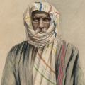
Beer-Gaal Posted September 29, 2010 i don't know him ,,,,but i'm sure he is not Galgalawi,,,,he should be from somewhere in northern Sanaag if he is Maakhiri after all. Quote Share this post Link to post Share on other sites
Xudeedi Posted September 29, 2010 Originally posted by Jacaylbaro: Idaa Ra'ayta Xudeedi Fahuwa ahlu galgala Aw Ida ra'aytahuu cinda Nasir fahuwa nafsuh Rawaahu akhuunaa Goodane, minal Hargaisaawi. Muntafaqun Calayh inkastoo dhawaanahaan reer Galgala carabigu aad u barteen, aniguse qaybta arimaha dibada baan u qaabilsanahay. War Jacaylbaro, Maakhir is a country 400 km square, this man is from central Makhir. Waxaan ku moodaye nin qowmiyada Makhir kala yaqaan, see alla kuu galay. Quote Share this post Link to post Share on other sites
Jacaylbaro Posted September 29, 2010 Qowmiyada waan kala aqaan ashkhaastase ma wada baran karo ......... waanse gartay inaanuu ceel-buh ka sokayn ninkaasi Quote Share this post Link to post Share on other sites
Chimera Posted September 29, 2010 Impressive man with a clear understanding of our position accompanied with a real vision. I prefer him in the big seat, than miskiin Shariif. Quote Share this post Link to post Share on other sites
Taleexi Posted September 29, 2010 Great figure.. Go Ali Fatah. Quote Share this post Link to post Share on other sites